
寄付をします
次の冒険に備えよう:
Amazonアソシエイトとして、このサイトは対象となる購入から手数料を受け取りますが、お客様の負担はありません。
Caucasus Mountains地形図
地図をクリックすると標高が表示されます。
寄付をします
次の冒険に備えよう:
Amazonアソシエイトとして、このサイトは対象となる購入から手数料を受け取りますが、お客様の負担はありません。
Caucasus Mountains
The climate of the Caucasus varies both vertically (according to elevation) and horizontally (by latitude and location). Temperature generally decreases as elevation rises. Average annual temperature in Sukhumi, Abkhazia at sea level is 15 °C (59 °F) while on the slopes of Mt.Kazbek at an elevation of 3,700 metres (12,100 ft), average annual temperature falls to −6.1 °C (21.0 °F). The northern slopes of the Greater Caucasus Mountain Range are 3 °C (5.4 °F) colder than the southern slopes. The highlands of the Lesser Caucasus Mountains in Armenia, Azerbaijan, and Georgia are marked by sharp temperature contrasts between the summer and winter months due to a more continental climate.
寄付をします
次の冒険に備えよう:
Amazonアソシエイトとして、このサイトは対象となる購入から手数料を受け取りますが、お客様の負担はありません。
この地図について
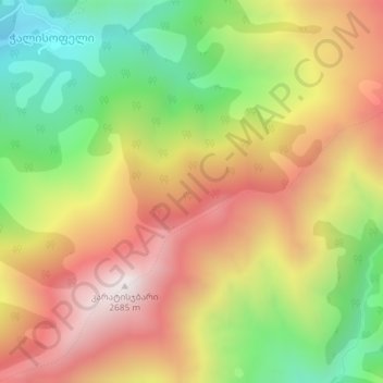
名前:Caucasus Mountainsの地形図、標高、地勢。
平均標高:2,188 m
最低標高:1,678 m
最大標高:2,683 m
寄付をします
次の冒険に備えよう:
Amazonアソシエイトとして、このサイトは対象となる購入から手数料を受け取りますが、お客様の負担はありません。