
寄付をします
次の冒険に備えよう:
Amazonアソシエイトとして、このサイトは対象となる購入から手数料を受け取りますが、お客様の負担はありません。
Lamoille地形図
地図をクリックすると標高が表示されます。
寄付をします
次の冒険に備えよう:
Amazonアソシエイトとして、このサイトは対象となる購入から手数料を受け取りますが、お客様の負担はありません。
この地図について
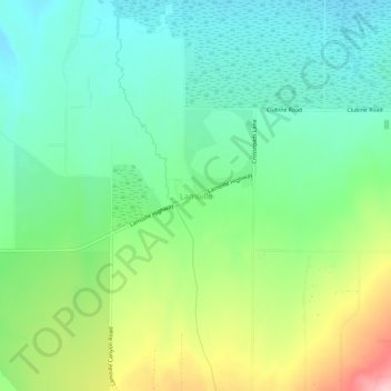
名前:Lamoilleの地形図、標高、地勢。
場所:Lamoille, Elko County, Nevada, 89828, United States (40.70798 -115.49839 40.74798 -115.45839)
平均標高:1,799 m
最低標高:1,740 m
最大標高:1,926 m
寄付をします
次の冒険に備えよう:
Amazonアソシエイトとして、このサイトは対象となる購入から手数料を受け取りますが、お客様の負担はありません。
その他の地形図
地図をクリックすると、その地形、その標高、その地勢が表示されます。
Ruby Mountains
United States > Nevada > Elko County
The Ruby Mountains (Shoshoni: 'Duka Doya', meaning “Snowcapped”) are a mountain range, primarily located within Elko County with a small extension into White Pine County, in Nevada, United States. Most of the range is included within the Humboldt-Toiyabe National Forest. The range reaches a maximum…
平均標高:1,962 m
Wells
United States > Nevada > Elko County
According to the United States Census Bureau, the city has a total area of 6.9 square miles (18 km2), all land, at an elevation of 5,630 feet (1,720 m).
平均標高:1,744 m
寄付をします
次の冒険に備えよう:
Amazonアソシエイトとして、このサイトは対象となる購入から手数料を受け取りますが、お客様の負担はありません。
Wells
United States > Nevada > Elko County
According to the United States Census Bureau, the city has a total area of 6.9 square miles (18 km2), all land, at an elevation of 5,630 feet (1,720 m).
平均標高:1,744 m
寄付をします
次の冒険に備えよう:
Amazonアソシエイトとして、このサイトは対象となる購入から手数料を受け取りますが、お客様の負担はありません。
Carlin
United States > Nevada > Elko County
Carlin is a city in Elko County of northeast Nevada, United States, and 23 miles (37 km) west of the city of Elko. As of the 2010 census, its population was 2,368, up from 2,161 at the 2000 census. Carlin sits along Interstate 80 at an elevation of approximately 4,900 feet (1,500 m). The city was named for…
平均標高:1,522 m