

寄付をします
次の冒険に備えよう:
Amazonアソシエイトとして、このサイトは対象となる購入から手数料を受け取りますが、お客様の負担はありません。
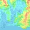
Lagoa地形図
地図をクリックすると標高が表示されます。
寄付をします
次の冒険に備えよう:
Amazonアソシエイトとして、このサイトは対象となる購入から手数料を受け取りますが、お客様の負担はありません。
この地図について

名前:Lagoaの地形図、標高、地勢。
場所:Lagoa, Lagoa e Carvoeiro, Lagoa, Faro, 8400-343, Portugal (36.97629 -8.61408 37.29629 -8.29408)
平均標高:53 m
最低標高:-5 m
最大標高:576 m
寄付をします
次の冒険に備えよう:
Amazonアソシエイトとして、このサイトは対象となる購入から手数料を受け取りますが、お客様の負担はありません。
その他の地形図
地図をクリックすると、その地形、その標高、その地勢が表示されます。


Loulé
Loulé is well known for the sandy beaches, such as Quarteira. Inland, Loulé shows a rich geology, paleontology, and wildlife. The seat of the municipality, the city of Loulé proper, is about 10 kilometres inland from the nearest coast at an elevation exceeding 100 meters and higher.
平均標高:222 m


寄付をします
次の冒険に備えよう:
Amazonアソシエイトとして、このサイトは対象となる購入から手数料を受け取りますが、お客様の負担はありません。

Monchique
Monchique has a Mediterranean climate with warm to hot summers and mild, wet winters. Due to its altitude and location, right between the valley formed by the Serra de Monchique, precipitation in the winter is much larger than anywhere else on the Algarve. Its position on the southwest corner of Portugal gives…
平均標高:206 m

Monchique
Monchique has a Mediterranean climate with warm to hot summers and mild, wet winters. Due to its altitude and location, right between the valley formed by the Serra de Monchique, precipitation in the winter is much larger than anywhere else on the Algarve. Its position on the southwest corner of Portugal gives…
平均標高:206 m

寄付をします
次の冒険に備えよう:
Amazonアソシエイトとして、このサイトは対象となる購入から手数料を受け取りますが、お客様の負担はありません。


Portimão
The geographical distribution of the altitude and relief of the municipality of Portimão generically follow the three types of territory present in the Barlavento: the coastal region, the Barrocal (a region between the coastal region and the mountains) and the mountains up north. Each one with their own…
平均標高:67 m
寄付をします
次の冒険に備えよう:
Amazonアソシエイトとして、このサイトは対象となる購入から手数料を受け取りますが、お客様の負担はありません。


Portimão
The geographical distribution of the altitude and relief of the municipality of Portimão generically follow the three types of territory present in the Barlavento: the coastal region, the Barrocal (a region between the coastal region and the mountains) and the mountains up north. Each one with their own…
平均標高:67 m

寄付をします
次の冒険に備えよう:
Amazonアソシエイトとして、このサイトは対象となる購入から手数料を受け取りますが、お客様の負担はありません。


Monchique
Monchique has a Mediterranean climate with warm to hot summers and mild, wet winters. Due to its altitude and location, right between the valley formed by the Serra de Monchique, precipitation in the winter is much larger than anywhere else on the Algarve. Its position on the southwest corner of Portugal gives…
平均標高:206 m
寄付をします
次の冒険に備えよう:
Amazonアソシエイトとして、このサイトは対象となる購入から手数料を受け取りますが、お客様の負担はありません。


寄付をします
次の冒険に備えよう:
Amazonアソシエイトとして、このサイトは対象となる購入から手数料を受け取りますが、お客様の負担はありません。


寄付をします
次の冒険に備えよう:
Amazonアソシエイトとして、このサイトは対象となる購入から手数料を受け取りますが、お客様の負担はありません。


寄付をします
次の冒険に備えよう:
Amazonアソシエイトとして、このサイトは対象となる購入から手数料を受け取りますが、お客様の負担はありません。


寄付をします
次の冒険に備えよう:
Amazonアソシエイトとして、このサイトは対象となる購入から手数料を受け取りますが、お客様の負担はありません。


寄付をします
次の冒険に備えよう:
Amazonアソシエイトとして、このサイトは対象となる購入から手数料を受け取りますが、お客様の負担はありません。


寄付をします
次の冒険に備えよう:
Amazonアソシエイトとして、このサイトは対象となる購入から手数料を受け取りますが、お客様の負担はありません。

寄付をします
次の冒険に備えよう:
Amazonアソシエイトとして、このサイトは対象となる購入から手数料を受け取りますが、お客様の負担はありません。


寄付をします
次の冒険に備えよう:
Amazonアソシエイトとして、このサイトは対象となる購入から手数料を受け取りますが、お客様の負担はありません。


寄付をします
次の冒険に備えよう:
Amazonアソシエイトとして、このサイトは対象となる購入から手数料を受け取りますが、お客様の負担はありません。

São Brás de Alportel
During the 19th century the parish became an important economic center. Cork oak plantations encouraged commercial development and made São Brás de Alportel the largest cork producing center in Portugal. At the beginning of the 20th century (1912), São Brás de Alportel was the most populated parish in the…
平均標高:322 m

寄付をします
次の冒険に備えよう:
Amazonアソシエイトとして、このサイトは対象となる購入から手数料を受け取りますが、お客様の負担はありません。


寄付をします
次の冒険に備えよう:
Amazonアソシエイトとして、このサイトは対象となる購入から手数料を受け取りますが、お客様の負担はありません。


寄付をします
次の冒険に備えよう:
Amazonアソシエイトとして、このサイトは対象となる購入から手数料を受け取りますが、お客様の負担はありません。
Portimão
The geographical distribution of the altitude and relief of the municipality of Portimão generically follow the three types of territory present in the Barlavento: the coastal region, the Barrocal (a region between the coastal region and the mountains) and the mountains up north. Each one with their own…
平均標高:67 m


寄付をします
次の冒険に備えよう:
Amazonアソシエイトとして、このサイトは対象となる購入から手数料を受け取りますが、お客様の負担はありません。


寄付をします
次の冒険に備えよう:
Amazonアソシエイトとして、このサイトは対象となる購入から手数料を受け取りますが、お客様の負担はありません。
