
寄付をします
次の冒険に備えよう:
Amazonアソシエイトとして、このサイトは対象となる購入から手数料を受け取りますが、お客様の負担はありません。
Deir Zenoun地形図
地図をクリックすると標高が表示されます。
寄付をします
次の冒険に備えよう:
Amazonアソシエイトとして、このサイトは対象となる購入から手数料を受け取りますが、お客様の負担はありません。
この地図について
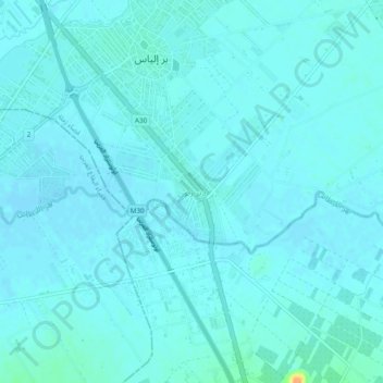
名前:Deir Zenounの地形図、標高、地勢。
場所:Deir Zenoun, Zahlé District, Beqaa Governorate, Lebanon (33.74024 35.88949 33.78024 35.92949)
平均標高:871 m
最低標高:867 m
最大標高:905 m
寄付をします
次の冒険に備えよう:
Amazonアソシエイトとして、このサイトは対象となる購入から手数料を受け取りますが、お客様の負担はありません。
その他の地形図
地図をクリックすると、その地形、その標高、その地勢が表示されます。
寄付をします
次の冒険に備えよう:
Amazonアソシエイトとして、このサイトは対象となる購入から手数料を受け取りますが、お客様の負担はありません。
Shouf Cedar Biosphere Reserve Limit
Precipitation in the watershed is the source of both surface streamflow and groundwater. The major portion of this occurs as rain. Snowfall often occurs at the upper elevations but snow seldom persists more than a few days and disappears before the end of the rainy season. Normally snow has little overall…
平均標高:980 m
寄付をします
次の冒険に備えよう:
Amazonアソシエイトとして、このサイトは対象となる購入から手数料を受け取りますが、お客様の負担はありません。