Thoubal地形図
地図をクリックすると標高が表示されます。
Thoubal
The district occupies the larger part of the eastern half of the Manipur Valley. The shape of the district is an irregular triangle with its base facing north. It lies between 23° 45' – 24° 45' North latitudes and 93° 45' – 94° 15' East longitudes. Its average elevation is about 790 m above the sea level. The district is dotted by a few hillocks and hills of low heights. Of these, Punam hill has an elevation of 1009 m above the sea level.
この地図について

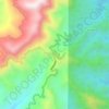
名前:Thoubalの地形図、標高、地勢。
場所:Thoubal, Manipur, India (24.52011 93.88858 24.72898 94.14021)
平均標高:813 m
最低標高:764 m
最大標高:1,490 m
その他の地形図
地図をクリックすると、その地形、その標高、その地勢が表示されます。