

Kangchenjunga地形図
地図をクリックすると標高が表示されます。
Kangchenjunga
Kangchenjunga Main is the highest elevation of the Brahmaputra River basin, which forms part of the southeast Asian monsoon regime and is among the globally largest river basins. Kangchenjunga is one of six peaks above 8,000 m (26,000 ft) located in the basin of the Kosi River, which is among the largest tributaries of the Ganges. The Kangchenjunga massif forms also part of the Ganges Basin.
この地図について
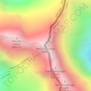
名前:Kangchenjungaの地形図、標高、地勢。
場所:Kangchenjunga, Chungthang, Mangan, Sikkim, India (27.70296 88.14743 27.70306 88.14753)
平均標高:7,725 m
最低標高:6,553 m
最大標高:8,587 m
その他の地形図
地図をクリックすると、その地形、その標高、その地勢が表示されます。

Gurudongmar
India > Sikkim > Chungthang
Gurudongmar Lake is one of the highest lakes in the world and in India, at an elevation of 5,430 m (17,800 ft) according to the Government of Sikkim. It is located in the Great Himalayas in the Mangan District in Indian state of Sikkim, and considered sacred by Buddhists and Sikhs. The lake is named after…
平均標高:5,232 m


