
寄付をします
次の冒険に備えよう:
Amazonアソシエイトとして、このサイトは対象となる購入から手数料を受け取りますが、お客様の負担はありません。
General Carlos Real地形図
地図をクリックすると標高が表示されます。
寄付をします
次の冒険に備えよう:
Amazonアソシエイトとして、このサイトは対象となる購入から手数料を受け取りますが、お客様の負担はありません。
この地図について
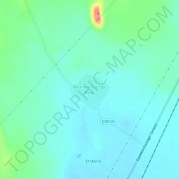
名前:General Carlos Realの地形図、標高、地勢。
場所:General Carlos Real, Municipio de Durango, Durango, Mexico (24.26444 -104.47217 24.30444 -104.43217)
平均標高:1,882 m
最低標高:1,865 m
最大標高:1,955 m
寄付をします
次の冒険に備えよう:
Amazonアソシエイトとして、このサイトは対象となる購入から手数料を受け取りますが、お客様の負担はありません。
その他の地形図
地図をクリックすると、その地形、その標高、その地勢が表示されます。
Durango
Mexico > Durango > Municipio de Durango
Durango (Spanish pronunciation: [duˈɾaŋɡo], Southeastern Tepehuan: Korian), is the capital and largest city of the northern Mexican state of Durango and the seat of the Durango municipality. It has a population of 654,876 as of the 2015 census. The city's official name is Victoria de Durango, Victoria…
平均標高:1,936 m
Durango
Mexico > Durango > Municipio de Durango
Durango (Spanish pronunciation: [duˈɾaŋɡo], Southeastern Tepehuan: Korian) is the capital and largest city of the northern Mexican state of Durango and the seat of the Durango municipality. It has a population of 654,876 as of the 2015 census. The city's official name is Victoria de Durango, Victoria…
平均標高:1,936 m
Durango
Mexico > Durango > Municipio de Durango
Durango (Spanish pronunciation: [duˈɾaŋɡo], Southeastern Tepehuan: Korian) is the capital and largest city of the northern Mexican state of Durango and the seat of the municipality of Durango. It has a population of 616,068 as of the 2020 census with 688,697 living in the municipality. The city's official…
平均標高:1,936 m