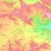
Secunderabad地形図
地図をクリックすると標高が表示されます。
Secunderabad
Situated in the North of Hyderabad at 17°27′N 78°30′E / 17.45°N 78.5°E / 17.45; 78.5., Secunderabad lies on the northern part of the Deccan Plateau. Secunderabad has an average elevation of 543 metres (1781 ft). Most of the area has a rocky terrain and some areas are hilly.
この地図について

名前:Secunderabadの地形図、標高、地勢。
場所:Secunderabad, Hyderabad, Telangana, 500003, India (17.27372 78.34068 17.59372 78.66068)
平均標高:544 m
最低標高:446 m
最大標高:634 m
その他の地形図
地図をクリックすると、その地形、その標高、その地勢が表示されます。
Hyderabad
India > Telangana > Bahadurpura mandal
Hyderabad (/ˈhaɪdərəbæd/ HY-dər-ə-bad; Telugu: [ˈɦaɪ̯daraːbaːd], Urdu: [ˈɦɛːdəɾaːbaːd]) is the capital and largest city of the Indian state of Telangana. It occupies 650 km2 (250 sq mi) on the Deccan Plateau along the banks of the Musi River, in the northern part of Southern India. With an…
平均標高:549 m