
Copper Pod地形図
地図をクリックすると標高が表示されます。
この地図について
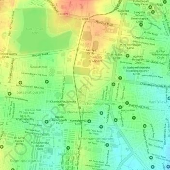
名前:Copper Podの地形図、標高、地勢。
平均標高:754 m
最低標高:728 m
最大標高:780 m
その他の地形図
地図をクリックすると、その地形、その標高、その地勢が表示されます。
Mysuru
India > Karnataka > Mysuru taluk > Mysuru
Mysore is situated at the foothills of the Chamundi Hills. At an altitude of 770 m (2,530 ft) above mean sea level, the city of Mysore is geographically located at 12° 18′ 26″ north latitude and 76° 38′ 59″ east longitude. It is about 140 km (87.0 mi) southwest of the state's capital, Bangalore, and…
平均標高:752 m