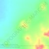
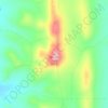
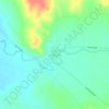
Inman Valley地形図
地図をクリックすると標高が表示されます。
Inman Valley
In the valley is Selwyn Rock (35°29′47″S 138°30′45″E / 35.4965°S 138.5124°E / -35.4965; 138.5124) a glaciated pavement in the bed of the Inman River. It was first described in 1859 by, and later named for, A.R.C. Selwyn,[17] who was Victorian Government geologist at the time. Glacial grooves and striations on the polished surface indicate glacial movement to the north-west. Boulder clays, tillites and erratics are also common in the area, which underwent glaciation during the Permian (approximately 270 Ma). The pavement was exposed during the Tertiary when the Inman River eroded the topography to its present-day surface. A cafe overlooks the glaciated bed of the river, with access onto the rock available via stairs and viewing platforms.
この地図について

名前:Inman Valleyの地形図、標高、地勢。
場所:Inman Valley, South Australia, 5211, Australia (-35.52639 138.39211 -35.43117 138.55962)
平均標高:212 m
最低標高:49 m
最大標高:443 m
その他の地形図
地図をクリックすると、その地形、その標高、その地勢が表示されます。

Adelaide
Australia > South Australia > Adelaide
Adelaide is north of the Fleurieu Peninsula, on the Adelaide Plains between the Gulf St Vincent and the low-lying Mount Lofty Ranges. The city stretches 20 km (12 mi) from the coast to the foothills, and 90 km (56 mi) from Gawler at its northern extent to Sellicks Beach in the south. According to the Regional…
平均標高:148 m













Port Neill
Matthew Flinders sailed past on 7 March 1802 and reported 'low front land, somewhat sandy, with raised land inland and of a barren appearance, its elevation diminishing to the northward.' The first land-based European exploration took place in April 1840, when the party of Governor Gawler, John Hill, and…
平均標高:9 m











Nullabor Plain
Australia > South Australia > Pastoral Unincorporated Area
One theory is that the whole area was uplifted by crustal movements in the Miocene, and since then, erosion by wind and rain has reduced its thickness. The plain has most likely never had any major defining topographic features, resulting in the extremely flat terrain across the plain today.
平均標高:117 m





Blue Lake
Australia > South Australia > Mount Gambier
Each November, the lake turns to a deep turquoise colour, gradually returning to a duller blue colour in late February to March. The exact cause of this phenomenon is still a matter of conjecture, but likely it involves the warming of the surface layers of the lake during the summer to around 20 °C (68 °F),…
平均標高:53 m