
Three Holes地形図
地図をクリックすると標高が表示されます。
この地図について
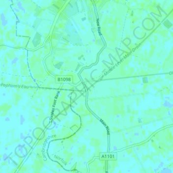
名前:Three Holesの地形図、標高、地勢。
平均標高:2 m
最低標高:-2 m
最大標高:6 m
その他の地形図
地図をクリックすると、その地形、その標高、その地勢が表示されます。
Clenchwarton
United Kingdom > England > Norfolk > King's Lynn and West Norfolk > Clenchwarton
平均標高:3 m
Docking
United Kingdom > England > Norfolk > King's Lynn and West Norfolk
Docking village in the centre of the parish is situated at an elevation of 82.7 metres (272 feet), which makes it one of the highest in Norfolk. It is surrounded by arable farmland having little woodland and is a nucleated settlement, with only one historical hamlet associated with it. This is Summerfield to…
平均標高:63 m
Castle Rising
United Kingdom > England > Norfolk > King's Lynn and West Norfolk > Castle Rising
平均標高:22 m
Hunstanton Beach
United Kingdom > England > Norfolk > King's Lynn and West Norfolk > Hunstanton > Old Hunstanton
平均標高:10 m
Docking
United Kingdom > England > Norfolk > King's Lynn and West Norfolk
Docking village in the centre of the parish is situated at an elevation of 82.7 metres (272 feet), which makes it one of the highest in Norfolk. It is surrounded by arable farmland having little woodland and is a nucleated settlement, with only one historical hamlet associated with it. This is Summerfield to…
平均標高:63 m