

Bhatsa地形図
地図をクリックすると標高が表示されます。
この地図について

名前:Bhatsaの地形図、標高、地勢。
場所:Bhatsa, Shahapur, Thane, Maharashtra, India (19.51304 73.41792 19.51376 73.41963)
平均標高:130 m
最低標高:56 m
最大標高:209 m
その他の地形図
地図をクリックすると、その地形、その標高、その地勢が表示されます。
Mumbai
India > Maharashtra > Mumbai
Mumbai is on a narrow peninsula on the southwest of Salsette Island, which lies between the Arabian Sea to the west, Thane Creek to the east and Vasai Creek to the north. Mumbai's suburban district occupies most of the island. Navi Mumbai is east of Thane Creek and Thane is north of Vasai Creek. Mumbai…
平均標高:18 m

Pune
Pune is situated at approximately 18° 32" north latitude and 73° 51" east longitude. The area of Pune district is 15,642 km2, and the municipal corporation area covers 518 km2. By road Pune is 149 km (93 mi) south-east of Mumbai, 580 km (360 mi) south-west of Indore, 695 km (432 mi) west of Nagpur, 1,173 km…
平均標高:616 m
Panvel
India > Maharashtra > Panvel > Panvel
Matheran is a hill station and a municipal council in the Raigad district in the Indian state of Maharashtra. It is a hill station in Karjat Tahsil and is also the smallest hill station in India. It is located on the Western Ghats range at an elevation of around 800 m (2,625 feet) above sea level. It is…
平均標高:75 m
Navi Mumbai
India > Maharashtra > Thane > Navi Mumbai
Navi Mumbai (Marathi pronunciation: , also known by its former name New Bombay), is a planned city off the west coast of the Indian state of Maharashtra in Konkan division. The city is divided into two parts, North Navi Mumbai and South Navi Mumbai, for the individual development of Panvel Mega City, which…
平均標高:30 m


Maharashtra
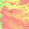
Maharashtra is the third largest state by area in India. The Western Ghats better known as Sahyadri, are a hilly range running parallel to the coast, at an average elevation of 1,200 metres (4,000 ft). Kalsubai, a peak in the Sahyadris, near Nashik city is the highest elevated point in Maharashtra. To the west…
平均標高:478 m


Mumbai
Mumbai is on a narrow peninsula on the southwest of Salsette Island, which lies between the Arabian Sea to the west, Thane Creek to the east and Vasai Creek to the north. Mumbai's suburban district occupies most of the island. Navi Mumbai is east of Thane Creek and Thane is north of Vasai Creek. Mumbai…
平均標高:18 m


Malegaon
India > Maharashtra > Malegaon Taluka
Malegaon(previously Maligaon) is at the confluence of the Girna and Mosam (previously Moosy) rivers, at elevation of 438 metres (1437 feet) at 18°25′N 77°32′E / 18.42°N 77.53°E / 18.42; 77.53.
平均標高:463 m


Mumbai
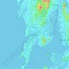
Mumbai lies at the mouth of the Ulhas River on the western coast of India, in the coastal region known as the Konkan. It sits on Salsette Island (Sashti Island), which it partially shares with the Thane district. Mumbai is bounded by the Arabian Sea to the west. Many parts of the city lie just above sea level,…
平均標高:13 m


Nashik
India > Maharashtra > Nashik Subdistrict
The city's tropical location and high altitude combine to give it a relatively mild version of a tropical wet and dry climate (Köppen Aw). Temperatures rise slightly in October, but this is followed by the cool season from November to February. The cool season sees warm temperatures of around 28 °C or 82.4…
平均標高:631 m


Kalasubai peak
India > Maharashtra > Akola > Karanda
Kalsubai (Marathi: कळसूबाई शिखर) is a mountain in the Western Ghats, located in the Indian state of Maharashtra. Its summit, situated at an elevation of 1,646 metres (5,400 ft), is the highest point in Maharashtra.
平均標高:1,210 m


Patan
India > Maharashtra > Patan
Patan is located at 17°22′N 73°54′E / 17.37°N 73.9°E / 17.37; 73.9. It has an average elevation of 582 metres (1909 feet).
平均標高:668 m


Chikhaldara
The sole hill resort in the Vidarbha region, it is situated at an altitude of 1118 meters with highest elevation point 1188 meters and has the added dimension of being the only coffee-growing area in Maharashtra. Chikhaldara has an annual rainfall of 154cm. Temperatures vary from 39C in summer to 5C in winter.…
平均標高:521 m


Akola District
Akola district lies in the northern plains of the Deccan Plateau. Akola district covers mostly plain topology with isolated hills and mounds except for the mountain ranges of Ajintha (Ajanta), located in the Southern tehsils of Patur and Barshi Takli, and the Satpuda mountain range that occupies some areas in…
平均標高:340 m

Buldhana District
Lonarkar Top (about 923 meters) is highest altitude in Buldhana District placed in Ambabarwa Wildlife Sanctuary.
平均標高:425 m


Ratnagiri
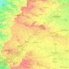
An outstanding feature of the geography of the district is its uneven or hill topography, with about 45% of the district being characterized as 'hilly'. Very narrow riverine plains fringe the coastline.
平均標高:301 m


Jalna District
The district occupies an area of 7,718 square kilometres (2,980 sq mi). The range of geographical latitudes and longitudes of the district is from 19.01' N to 21.03'N and from 75.04'E to 76.04'E, with gently to moderately sloping topography. The Northern part of the district is occupied by the Ajanta and…
平均標高:542 m


Nanded District
Nanded is bounded on the north by Yavatmal district of the Vidarbha region, with Latur on south-west, Parbhani and Hingoli districts on the west. On the eastern side lies Adilabad, Nirmal, Nizamabad and Kamareddy districts of Telangana state, and on the south lies Bidar of Karnataka state. The area presents…
平均標高:432 m

Latur District
Latur district is in the Marathwada region in Maharashtra in India, located between 17°52' North to 18°50' North and 76°18' East to 79°12' East in the Deccan plateau. It has an average elevation of 631 metres (2,070 ft) above mean sea level. The entire district of Latur is on the Balaghat plateau, 540 to…
平均標高:590 m


Baramati
Baramati Tehsil is located in Western Maharashtra. It belongs to Pune Division. It is located 100 km towards east from district headquarters Pune. 240 km from state capital Mumbai towards east. Baramati tehsil has its head quarter that is Baramati town. Baramati tehsil lies between 18º04΄ to 18°32΄ north…
平均標高:582 m


Nagpur
Nagpur is located at the exact centre of the Indian subcontinent, close to the geometric centre of the quadrilateral connecting the four major metros of India, viz. Chennai, Mumbai, New Delhi and Kolkata. The city has the Zero Mile Stone locating the geographical centre of India, which was used by the British…
平均標高:309 m


