
寄付をします
次の冒険に備えよう:
Amazonアソシエイトとして、このサイトは対象となる購入から手数料を受け取りますが、お客様の負担はありません。
Great Basin地形図
地図をクリックすると標高が表示されます。
寄付をします
次の冒険に備えよう:
Amazonアソシエイトとして、このサイトは対象となる購入から手数料を受け取りますが、お客様の負担はありません。
Great Basin
The Great Basin is the largest area of contiguous endorheic watersheds, those with no outlets, in North America. It spans nearly all of Nevada, much of Utah, and portions of California, Idaho, Oregon, Wyoming, and Baja California. It is noted for both its arid climate and the basin and range topography that varies from the North American low point at Badwater Basin in Death Valley to the highest point of the contiguous United States, less than 100 miles (160 km) away at the summit of Mount Whitney. The region spans several physiographic divisions, biomes, ecoregions, and deserts.
寄付をします
次の冒険に備えよう:
Amazonアソシエイトとして、このサイトは対象となる購入から手数料を受け取りますが、お客様の負担はありません。
この地図について
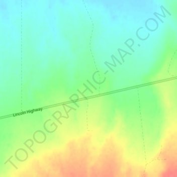
名前:Great Basinの地形図、標高、地勢。
場所:Great Basin, Eureka County, Nevada, United States (39.49995 -116.50005 39.50005 -116.49995)
平均標高:1,918 m
最低標高:1,896 m
最大標高:1,952 m
寄付をします
次の冒険に備えよう:
Amazonアソシエイトとして、このサイトは対象となる購入から手数料を受け取りますが、お客様の負担はありません。